|
17/07/2022 - Stelvio dal lato Svizzero |
| Cartografia |
|
Anche quest’anno si sale sul passo dello Stelvio. Una delle salite in bici più iconiche del nostro bel paese.
Questa volta però voglio salire dal versante Svizzero, versante utilizzato anche in occasione del giro d’Italia del 2017.
Parto alle 8.00 dal Prato dello Stelvio a quota 910 mslm. Pedalata di riscaldamento e si raggiunge Glorenza. Da qui svolta a sinistra e si inizia a percorrere la strada che mi porterà verso la Svizzera.
Poco dopo aver attraversato il confine Italia - Svizzera raggiungo la cittadina di Val Müstair, dove risiede un patrimonio Unesco, il convento Benedettino del VIII secolo di San Giovanni.
Ancora un paio di pedalate e raggiungo il paesino di Santa Maria Val Müstair 1380 mslm, in centro paese svolta a sinistra e qui inizio subito a capire cosa mi aspetta... bella rampa sopra il 10%... così inizia la salita che dovrà portami al passo Umbrail e dopo al passo Stelvio.
I primi 7 km difficilmente vanno sotto il 9% ma sono tutti all’ombra di un bellissimo bosco, fino al tornante dove trovi un bel ristorantino con vista sulla valle svizzera incantevole.
Dopo non è che vada meglio, solo che sei sotto il sole e anche se la quota inizia ad essere sopra i 2000 mslm, se il sole splende, fa comunque caldo.
Altri 6 km e raggiungo il Passo Umbrail 2510 mslm, bivio per chi vuole scendere a Bormio oppure salire al passo dello Stelvio.
Altri 3 km al 9% e finalmente raggiungo ’The king’ 2750 mslm. Qui mi aspetta un ottimo panino con wustel crauti e senape più una birra fresca, serviti di fronte un panorama incredibile, il versante dello Stelvio che dà verso ’le scalette’ (così sono chiamati gli ultimi 23 tornanti del lato Italiano).
Foto di rito e giù per i 28 km che mi riporteranno a Prato dello Stelvio. |
Giudizio sulla salita lato italiano e svizzero. Quello Italiano è più iconico per quello che ti si presenta difronte quando inizi ad affrontare le scalette finali. Quello Svizzero però è sicuramente più alberato e fresco, e soprattutto con meno traffico.
Altra cosa occhio alle fontane, l’ultima che si trova nel versante svizzero è dentro il paesetto di Santa Maria Val Müstair dopo hai ancora 17 km di salita. Sul versante italiano ci sono 2 fontane una di fronte il ristornate Rocca Bianca e una a metà delle scalette.
|
Distanza percorso : m.
Dislivello : m.
Quota massima : m.
|
|
|
Altimetria Terreno (Scala altezza: 1px=30 metri) (Scala distanza: 1px=30 metri) |
|
|
|
Altimetria Percorso (Scala altezza: 1px=30 metri) (Scala distanza: 1px=30 metri) |
|
|
| Tappe |
| Titolo | Veduta su passo Resia da Glorenza | | Testo | | | Link | | | Allegato | | | Altimetria | da 0 metri a 0 metri | | Distanza | 0 metri in linea d'aria, 0 metri percorsi |
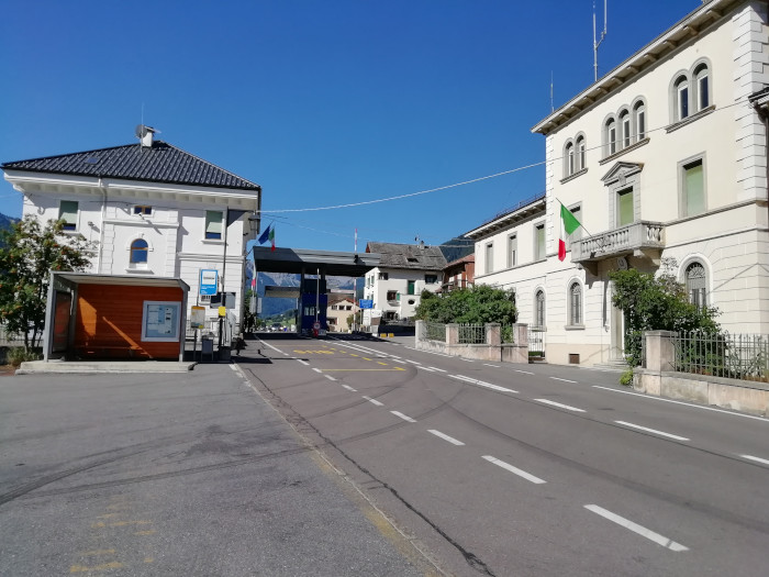
|  | | Titolo | Frontiera italia svizzera | | Testo | | | Link | | | Allegato | | | Altimetria | da 0 metri a 0 metri | | Distanza | 0 metri in linea d'aria, 0 metri percorsi |
|  | | Titolo | Monastero di San Giovanni | | Testo | | | Link |  | | Allegato | | | Altimetria | da 0 metri a 0 metri | | Distanza | 0 metri in linea d'aria, 0 metri percorsi |
|  | | Titolo | Santa maria | | Testo | | | Link | | | Allegato | | | Altimetria | da 0 metri a 0 metri | | Distanza | 0 metri in linea d'aria, 0 metri percorsi |
|  | | Titolo | Veduta sul passo che porta a Livigno | | Testo | | | Link | | | Allegato | | | Altimetria | da 0 metri a 0 metri | | Distanza | 0 metri in linea d'aria, 0 metri percorsi |
|  | | Titolo | Sullo stelvio sale di tutto | | Testo | | | Link | | | Allegato | | | Altimetria | da 0 metri a 0 metri | | Distanza | 0 metri in linea d'aria, 0 metri percorsi |
|  | | Titolo | Salita verso passo Umbrail | | Testo | | | Link | | | Allegato | | | Altimetria | da 0 metri a 0 metri | | Distanza | 0 metri in linea d'aria, 0 metri percorsi |
|  | | Titolo | Punto di incontro Italia Austria Svizzera | | Testo | | | Link | | | Allegato | | | Altimetria | da 0 metri a 0 metri | | Distanza | 0 metri in linea d'aria, 0 metri percorsi |
|  | | Titolo | Manca poco alla cima | | Testo | | | Link | | | Allegato | | | Altimetria | da 0 metri a 0 metri | | Distanza | 0 metri in linea d'aria, 0 metri percorsi |
|  | | Titolo | Quando la fame è tanta... | | Testo | | | Link | | | Allegato | | | Altimetria | da 0 metri a 0 metri | | Distanza | 0 metri in linea d'aria, 0 metri percorsi |
|  | | Titolo | Passo dello Stelvio | | Testo | | | Link | | | Allegato | | | Altimetria | da 0 metri a 0 metri | | Distanza | 0 metri in linea d'aria, 0 metri percorsi |
|  | | Titolo | The bike | | Testo | | | Link | | | Allegato | | | Altimetria | da 0 metri a 0 metri | | Distanza | 0 metri in linea d'aria, 0 metri percorsi |
|  | | Titolo | Le scalette | | Testo | | | Link | | | Allegato | | | Altimetria | da 0 metri a 0 metri | | Distanza | 0 metri in linea d'aria, 0 metri percorsi |
|  | | Titolo | Fanno impressione a.... | | Testo | | | Link | | | Allegato | | | Altimetria | da 0 metri a 0 metri | | Distanza | 0 metri in linea d'aria, 0 metri percorsi |
|  | | Titolo | Trafoi | | Testo | | | Link | | | Allegato | | | Altimetria | da 0 metri a 0 metri | | Distanza | 0 metri in linea d'aria, 0 metri percorsi |
|  |
|
|
")
")
")
")
")
")
")