|
21/08/2024 - Anello del Civetta |
| Cartografia |
|
Questa avventura inizia da Pecol, sulla Val Zoldana sotto il massiccio del Civetta.
Appoggiandomi al rifugio Tissi e al Carestiato per 2 notti, l’obbiettivo è di completare l’anello del Civetta.
- I giorno
-
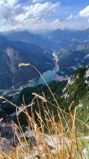
Lascio l’auto al parcheggio della funivia di Pecol, prendo il sentiero che porta al Rifugio Coldai. Breve pausa e subito raggiungo il lago di Coldai dove consumo un veloce pranzo. Da qui riparto per raggiungere una forcella che si affaccia sulla parete verticale del Civetta. Il rifugio Tissi sembra poco distante, in realtà serve più di un’ora per raggiungerlo. Raggiungo il Tissi e da qui godo di un panorama incredibile sia sul Civetta che su Alleghe, guardate le foto e il video per credere.
- II giorno
-
Sveglia alle 7.00, colazione abbondante e si riparte. La prima parte del sentiero è in discesa e molto tranquilla; si raggiunge il rifugio Vazzoler per una piccola pausa.
Da qui si riparte e dopo poco inizia un pezzo del sentiero molto impegnativo, il N° 554. Si attraversa prima un bosco molti fitto e ripido, subito dopo inizia una pietraia con un continuo saliscendi e l’attraversamento di punti esposti. Si superano due forcelle e il sentiero svolta a sinistra per un tratto più boscoso. Ultima forcella e già si intravede il rifugio Carestiato. Dopo altri 45 minuti di cammino raggiungo il rifugio abbastanza stanco.
- III giorno
-
Anche oggi la colazione è poco dopo l’alba. Inizio l’ultima giornata che mi riporterà al punto di partenza. Prima parte del sentiero molto tranquilla. Supero il passo Duran tenendomi più interno rispetto la strada, poco dopo raggiungo la strada che decido di percorrere fino al paesino Chiesa. Da qui inizia una salita prima su strada asfaltata fino a raggiungere Casera della Grava poi su strada sterrata fino a forcella della Grava. Da qui inizia una discesa su sentiero che poco dopo incrocia le piste da scii che scendono fino a Pecol. Qui mi aspetta una bella birretta fresca.
3 belle giornate, trascorse in uno dei patrimoni UNESCO. Un saluto e un particolare ringraziamento va ai due gestori dei rifugi dove ho dormiti, bellissime persone. |
Il sentiero percorso nei prime due giorni è un tratto dell’alta via 1 delle dolomiti. Moltissimi gli stranieri che la percorrono. Ho conosciuto americani, spagnoli, tedeschi, asiatici... di italiani che pernottavano nei due rifugi pochissimi.
Ho conosciuto anche un paio di tedeschi che stavano facendo la Monaco Venezia, un trekking di 28 giorni e 600km, ammirevole.
|
Distanza percorso : 39.94 Km.
Dislivello : 2039 m.
Quota massima : 2220 m.
|
|
|
Altimetria Terreno (Scala altezza: 1px=19 metri) (Scala distanza: 1px=45 metri) |
 |  | | 12.7% |
|  |  | | 7.0% |
|  |  | | 12.9% |
|  |  | | 10.1% |
|  |  | | 12.2% |
|  |  | | 7.3% |
|  |  | | 10.8% |
|  |  | | 10.8% |
|
|
|
Altimetria Percorso (Scala altezza: 1px=19 metri) (Scala distanza: 1px=45 metri) |
 |  | | 12.7% |
|  |  | | 7.0% |
|  |  | | 12.9% |
|  |  | | 10.1% |
|  |  | | 12.2% |
|  |  | | 7.3% |
|  |  | | 10.8% |
|  |  | | 10.8% |
|
|
| Tappe |
| Titolo | Lago Coldai | | Testo | | | Link | | | Allegato | | | Altimetria | da 1350 metri a 2140 metri | | Distanza | 6240 metri in linea d'aria, 6240 metri percorsi |
| 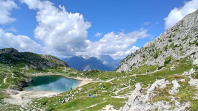 | | Titolo | Parete del Civetta | | Testo | | | Link | | | Allegato | | | Altimetria | da 2140 metri a 2000 metri | | Distanza | 2000 metri in linea d'aria, 2000 metri percorsi |
| 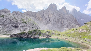 | | Titolo | Si vede rifugio Tissi | | Testo | | | Link |  | | Allegato | | | Altimetria | da 2000 metri a 2220 metri | | Distanza | 1700 metri in linea d'aria, 1700 metri percorsi |
| 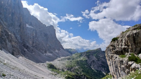 | | Titolo | Lago di Alleghe dal Tissi. | | Testo | | | Link | | | Allegato | | | Altimetria | da 2220 metri a 1411 metri | | Distanza | 8000 metri in linea d'aria, 8000 metri percorsi |
|  | | Titolo | Direzione rif.Vazzoler | | Testo | | | Link | | | Allegato | | | Altimetria | da 1411 metri a 1900 metri | | Distanza | 4000 metri in linea d'aria, 4000 metri percorsi |
| 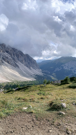 | | Titolo | Alba del secondo giorno | | Testo | | | Link | | | Allegato | | | Altimetria | da 1900 metri a 1240 metri | | Distanza | 9000 metri in linea d'aria, 9000 metri percorsi |
| 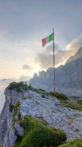 | | Titolo | Direzione Agordo dal Carestiato | | Testo | | | Link |  | | Allegato | | | Altimetria | da 1240 metri a 1780 metri | | Distanza | 5000 metri in linea d'aria, 5000 metri percorsi |
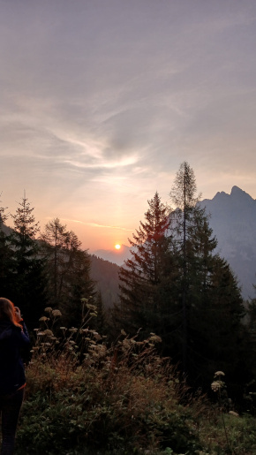
| 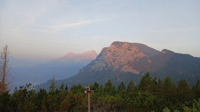 | | Titolo | Alba del terzo giorno | | Testo | | | Link |  | | Allegato | | | Altimetria | da 1780 metri a 1350 metri | | Distanza | 4000 metri in linea d'aria, 4000 metri percorsi |
|  |
|
|