|
25/07/2021 - Passo Gavia |
| Cartografia |
|
Oggi temo di essermi cimentato in una impresa più grande di mè.
IL GAVIAApprofitto della giornata in cui chiudono il traffico motorizzato sul passo e la strada è solo di noi ciclisti, per affrontare una salita che ha fatto la storia del ciclismo, con imprese rimaste nell’immaginario collettivo come il giro del 1988.
Parto poco distante da Ponte di legno. I primi KM sono tranquilli, fino al raggiungimento del Ristoro Pietra Rossa. Da qui inizia il vero GAVIA.
4-5 km al 12% di pendenza con punte del 15%. Da subito capisco che se voglio arrivare alla fine devo gestirmi. Salgo regolare con una pedalata molto tranquilla, e la cosa funziona. Non vado mai fuori giri e le gambe girano... lo sto scalando questo mostro...
Quando il bosco finisce le pendenze diventano più digeribili... siamo sul 10%. La strada è stupenda, segue il crinale della montagna senza più tornanti fino all’imbocco della galleria.
In galleria il problema è il freddo che inizia a farsi sentire. Quando esco sono anche circondato da nuvole, ma ormai vedo la cima, mancano un paio di tornanti.
E’ ancora dura però e a questo si aggiunge un fondo stradale compromesso.
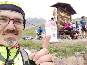
Svolto l’ultimo tornante e finalmente vedo il rifugio, la strada ora è bellissima appena asfaltata. Ormai è fatta. Provo una sensazione incredibile, un misto di soddisfazione, gioia, voglia di urlare a tutti... ce l’ho fatta, ho scalato il GAVIA.
|
Da segnalarvi ho due punti:
1 - La galleria, a pochi chilometri dalla vetta, non è illuminata nei giorni normali. Io ho trovato un faro acceso che dava anche fastidio, solo perchè era la giornata dedicata ai ciclisti e per una gara in corso. Serve una pila frontale.
2 - Dopo la galleria ci sono 3 - 4 tornanti con un manto stradale devastato, c’è il rischio di forare. |
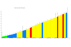
Distanza percorso : 17.435 Km.
Dislivello : 1392 m.
Quota massima : 2650 m.
|
|
|
Altimetria Terreno (Scala altezza: 1px=30 metri) (Scala distanza: 1px=30 metri) |
 |  | | 6.8% |
|  |  | | 9.3% |
|  |  | | 8.2% |
|  |  | | 10.2% |
|  |  | | 9.1% |
|  |  | | 0.0% |
|
|
|
Altimetria Percorso (Scala altezza: 1px=30 metri) (Scala distanza: 1px=30 metri) |
 |  | | 6.8% |
|  |  | | 9.3% |
|  |  | | 8.2% |
|  |  | | 10.2% |
|  |  | | 9.1% |
|  |  | | 0.0% |
|
|
| Tappe |
| Titolo | Partenza | | Testo | Parto poco prima Ponte di legno dalla strada che scende dal passo del Tonale. | | Link | | | Allegato | | | Altimetria | da 1258 metri a 1600 metri | | Distanza | 5000 metri in linea d'aria, 5000 metri percorsi |
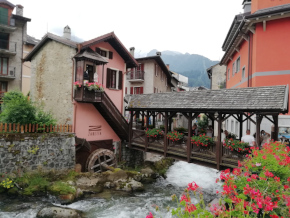
|  | | Titolo | Ponte di legno | | Testo | | | Link | | | Allegato | | | Altimetria | da 0 metri a 0 metri | | Distanza | 0 metri in linea d'aria, 0 metri percorsi |
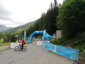
|  | | Titolo | Inizia l’inferno | | Testo | | | Link | | | Allegato | | | Altimetria | da 1600 metri a 2000 metri | | Distanza | 4300 metri in linea d'aria, 4300 metri percorsi |
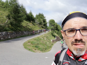
|  | | Titolo | Si respira un po | | Testo | | | Link | | | Allegato | | | Altimetria | da 2000 metri a 2225 metri | | Distanza | 2745 metri in linea d'aria, 2745 metri percorsi |
|  | | Titolo | Passaggio bellissimo della salita | | Testo | | | Link | | | Allegato | | | Altimetria | da 0 metri a 0 metri | | Distanza | 0 metri in linea d'aria, 0 metri percorsi |
| 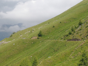 | | Titolo | Lago Nero | | Testo | | | Link | | | Allegato | | | Altimetria | da 2225 metri a 2450 metri | | Distanza | 2200 metri in linea d'aria, 2200 metri percorsi |
| 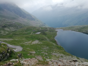 | | Titolo | Passo Gavia | | Testo | | | Link | | | Allegato | | | Altimetria | da 2450 metri a 2650 metri | | Distanza | 2190 metri in linea d'aria, 2190 metri percorsi |
| 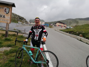 | | Titolo | E anche questo è in bacheca.... | | Testo | | | Link |  | | Allegato | | | Altimetria | da 2650 metri a 2650 metri | | Distanza | 1000 metri in linea d'aria, 1000 metri percorsi |
|  |
|
|