|
30/07/2023 - Alta via di Merano |
| Cartografia |
|
Oggi vi racconto l’avventura che ho vissuto nel fare l’Alta via di Merano.
Sono partito una domenica dopo essere salito ai 1400 mslm della funivia la Muta, presso Tirolo, vicino a Merano.
Da qui sono iniziati i miei 5 giorni di camminata che mi ha portato a percorrere oltre 90KM, superare 5100 metri di dislivello, attraverso valli incantevoli, passi a quasi 3000 metri di altitudine, immerso in un paesaggio stupendo, fatto di torrenti, cascate, laghi e custodito dagli abitanti del posto attraverso masi e rifugi.
Io l’ho percorsa in senso orario, con tappe che andavano da 14 km a un massimo di 23 km.
- I giorno
- Partenza dall’arrivo della funivia Muta, arrivo al maso Pirchhof, 18,3 KM. Tratto molto bello fatto di ponti sospesi da attraversare, da un continuo saliscendi. Lungo questo tratto si incontrano più punti dove mangiare o pernottare. Ritengo sia stato il tratto più impegnativo in particolar modo la parte finale, quando ho iniziato la gola dei 1000 scalini.
- II giorno
- Partenza dal maso Pirchof, arrivo al maso Rableidalm, 18,7 km. Questo tratto molto più regolare del precedente, si incrociano parecchi masi fino a Monte santa Caterina, dopo non ce ne sono fino ai 3 masi presenti nel lato Nord della val di Fossa, a quota 2000 mslm.
- III giorno
- Partenza dal maso Rableidalm, arrivo al maso Zeppichl, 17,5 km. Questa la parte più suggestiva di tutto il trekking. Si raggiungono i quasi 3000 mslm del passo Gelato. Il sentiero che sale è molto regolare, visibilissimo e privo di pericoli. Subito dopo il passo si vede il rifugio Petrarca. La discesa è un pò più nervosa, soprattutto dopo la metà, quando diventa più ripida e meno lastricata. A questo si è aggiunto il maltempo con una pioggia battente che ha complicato il tutto. Alla fine della discesa è obbligatorio fermarsi alla Malga Lazinser per mangiare, e nel mio caso per mettere addosso qualcosa di asciutto. Subito dopo si riparte per raggiungere il paesino di Zeppichl dove io ho pernottato.
- IV giorno
- Partenza dal maso Zeppichl, arrivo al maso Magdfeld, 23 km. Questo il tratto più regolare e lungo, per 20 km c’è una costante discesa fino alla quota minima di 800 mslm, ultimi 3 km si risale a 1150 mslm dove trovo il mio punto di pernottamento
- V giorno
- Partenza dal maso Magdfeld, arrivo alla funivia Muta, 14 km. Ultimo giorno, tratto più breve, ma non da sottovalutare, come tutto il tratto che dà verso il lato sud del trekking, presenta tratti impegnativi, di repentine discese e altrettanta salita. Raggiungo il punto di partenza e scendo al parcheggio auto con la funivia la Muta.
5 giorni intensi, duranti i quali ho conosciuto belle persone. Presso i masi si parla tranquillamente italiano, per il resto ho sempre parlato inglese, visto che la maggiora parte dei turisti ed escursionisti sono tedeschi o austriaci.
In conclusione direi che è un trekking da fare al 100%
|
Consigli per un trekking di questo tipo sono molti, io vi indicherò quelli che a mio avviso ho ritenuto importanti.
- Decidere da dove partire, e in base a questo dividere il tracciato in parti uguali come percorrenza.
- Contattare i Masi presso i quali si passeranno le notti.
- Zaino leggero, con massimo 2 paia uguali per ogni tipo di capo (magliette, pantaloni, intimo, calzini) poi un pile per il freddo e sicuramente antipioggia e cappello. Ciabatte per quando si sta in maso. Borraccia. Opzionali un saccopelo, e asciugamano (i masi forniscono sacchiletto e asciugamani).
- Buon allenamento... il percorso nella parte sud è molto nervoso, continui saliscendi molto impegnativi.
- Attenzione alla Val di Fosse, lato nord, completa assenza di copertura telefonica e quindi anche internet. In oltre, da monte santa Caterina fino al primo maso della Val di Fosse, 11 km, non ci sono punti per mangiare.
- Io ho trovato giorni freschi, ma se sei nel mese di luglio/agosto il caldo potrebbe essere un problema, crema da sole obbligatoria.
|
Distanza percorso : 92 Km.
Dislivello : 3200 m.
Quota massima : 2900 m.
|
|
|
Altimetria Terreno (Scala altezza: 1px=30 metri) (Scala distanza: 1px=100 metri) |
 |  | | 6.3% |
|  |  | | 4.0% |
|  |  | | 20.0% |
|  |  | | 30.0% |
|  |  | | 0.5% |
|  |  | | 5.6% |
|  |  | | 11.3% |
|  |  | | 20.0% |
|  |  | | 10.0% |
|  |  | | 4.5% |
|  |  | | 11.7% |
|  |  | | 2.1% |
|  |  | | 26.7% |
|  |  | | 40.0% |
|
|
|
Altimetria Percorso (Scala altezza: 1px=30 metri) (Scala distanza: 1px=100 metri) |
 |  | | 6.3% |
|  |  | | 4.0% |
|  |  | | 20.0% |
|  |  | | 30.0% |
|  |  | | 0.5% |
|  |  | | 5.6% |
|  |  | | 11.3% |
|  |  | | 20.0% |
|  |  | | 10.0% |
|  |  | | 4.5% |
|  |  | | 11.7% |
|  |  | | 2.1% |
|  |  | | 26.7% |
|  |  | | 40.0% |
|
|
| Tappe |
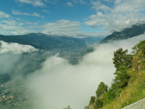
| Titolo | Si parte... | | Testo | Dopo aver fatto la funivia della Muta poco sopra Merano/Tirolo si inizia l’alta via di Merano.
91km 5500metri di dislivello per 5 giorni | | Link |  | | Allegato | | | Altimetria | da 1400 metri a 1900 metri | | Distanza | 8000 metri in linea d'aria, 8000 metri percorsi |
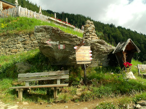
|  | | Titolo | Segnaletica | | Testo | Devo dire che tranne qualche breve passaggio, tutto il percorso è ben segnato. Difficilmente si perde la traccia del sentiero 24 | | Link | | | Allegato | | | Altimetria | da 0 metri a 0 metri | | Distanza | 0 metri in linea d'aria, 0 metri percorsi |
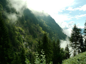
|  | | Titolo | Impegno | | Testo | Il primo giorno è risultato impegnativo dal punto di vista altimetrico.
Continui saliscendi e alla fine la gola dei 1000 scalini che proprio di uccide. | | Link | | | Allegato | | | Altimetria | da 1900 metri a 1500 metri | | Distanza | 10000 metri in linea d'aria, 10000 metri percorsi |
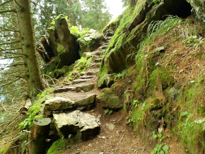
|  | | Titolo | Molti gli scalini in pietra | | Testo | Lungo tutto il sentiero si trovano spesso tratti di scalini fatti con rocce del posto. | | Link | | | Allegato | | | Altimetria | da 0 metri a 0 metri | | Distanza | 0 metri in linea d'aria, 0 metri percorsi |
|  | | Titolo | Ponti sospesi | | Testo | Lungo il tragitto si incontreranno 3 di questi ponti sospesi... tutti concentrati nei primi due giorni del mio percorso. | | Link | | | Allegato | | | Altimetria | da 1500 metri a 1200 metri | | Distanza | 1500 metri in linea d'aria, 1500 metri percorsi |
| 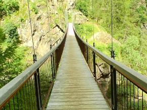 | | Titolo | Prima notte | | Testo | Prima notte trascorsa in questo maso.... | | Link |  | | Allegato | | | Altimetria | da 1200 metri a 1500 metri | | Distanza | 1000 metri in linea d'aria, 1000 metri percorsi |
| 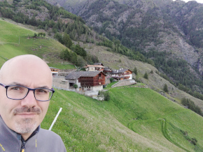 | | Titolo | Inizio secondo giorno | | Testo | | | Link | | | Allegato | | | Altimetria | da 0 metri a 0 metri | | Distanza | 0 metri in linea d'aria, 0 metri percorsi |
| 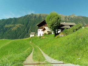 | | Titolo | Val Senales | | Testo | | | Link | | | Allegato | | | Altimetria | da 0 metri a 0 metri | | Distanza | 0 metri in linea d'aria, 0 metri percorsi |
| 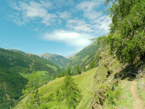 | | Titolo | Val Senales | | Testo | | | Link | | | Allegato | | | Altimetria | da 1500 metri a 1550 metri | | Distanza | 11000 metri in linea d'aria, 11000 metri percorsi |
| 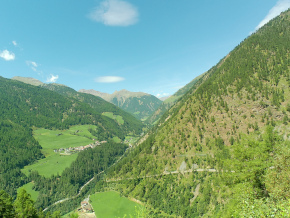 | | Titolo | Seconda notte | | Testo | | | Link |  | | Allegato | | | Altimetria | da 1550 metri a 2000 metri | | Distanza | 8000 metri in linea d'aria, 8000 metri percorsi |
| 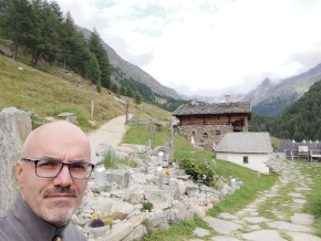 | | Titolo | Salita verso passo Gelato | | Testo | Terzo giorno; obbiettivo raggiungere il punto più alto dell’alta via.
i 2895 mslm di passo Gelato e subito dopo il rifugio petrarca | | Link | | | Allegato | | | Altimetria | da 2000 metri a 2900 metri | | Distanza | 8000 metri in linea d'aria, 8000 metri percorsi |
| 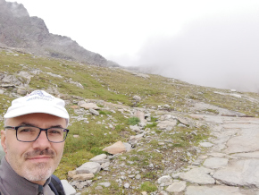 | | Titolo | Segnaletica sempre al top | | Testo | | | Link | | | Allegato | | | Altimetria | da 0 metri a 0 metri | | Distanza | 0 metri in linea d'aria, 0 metri percorsi |
| 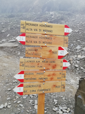 | | Titolo | La giornata non è delle migliori | | Testo | | | Link | | | Allegato | | | Altimetria | da 0 metri a 0 metri | | Distanza | 0 metri in linea d'aria, 0 metri percorsi |
| 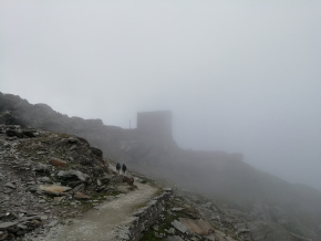 | | Titolo | Rifugio Petrarca | | Testo | | | Link | | | Allegato | | | Altimetria | da 2900 metri a 1900 metri | | Distanza | 5000 metri in linea d'aria, 5000 metri percorsi |
| 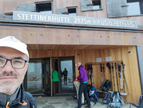 | | Titolo | Laghetti in quota | | Testo | | | Link | | | Allegato | | | Altimetria | da 0 metri a 0 metri | | Distanza | 0 metri in linea d'aria, 0 metri percorsi |
| 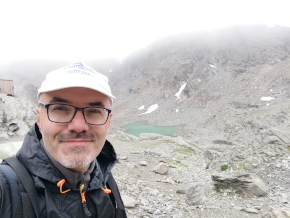 | | Titolo | Inizia a piovere... meglio scendere | | Testo | | | Link | | | Allegato | | | Altimetria | da 0 metri a 0 metri | | Distanza | 0 metri in linea d'aria, 0 metri percorsi |
| 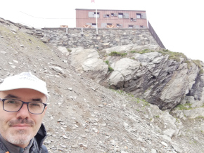 | | Titolo | Fine della discesa | | Testo | Finita la discesa facciamo un buon pranzo e subito dopo raggiungiamo Plan dove pernotteremo. | | Link |  | | Allegato | | | Altimetria | da 1900 metri a 1700 metri | | Distanza | 2000 metri in linea d'aria, 2000 metri percorsi |
| 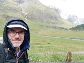 | | Titolo | Quarto Giorno | | Testo | | | Link | | | Allegato | | | Altimetria | da 1700 metri a 800 metri | | Distanza | 20000 metri in linea d'aria, 20000 metri percorsi |
| 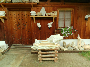 | | Titolo | Tratto del sentiero tranquillo | | Testo | | | Link | | | Allegato | | | Altimetria | da 800 metri a 1150 metri | | Distanza | 3000 metri in linea d'aria, 3000 metri percorsi |
| 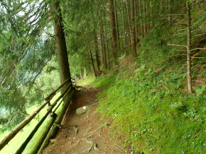 | | Titolo | Punti di ristoro lungo il percorso | | Testo | Ormai siamo arrivati all’ultimo maso dove trascorrerò ultima notte | | Link |  | | Allegato | | | Altimetria | da 1150 metri a 1400 metri | | Distanza | 12000 metri in linea d'aria, 12000 metri percorsi |
| 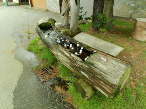 | | Titolo | Ultimo giorno | | Testo | | | Link | | | Allegato | | | Altimetria | da 1400 metri a 1000 metri | | Distanza | 1500 metri in linea d'aria, 1500 metri percorsi |
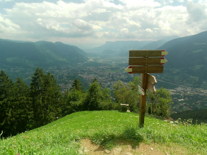
| 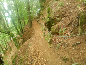 | | Titolo | Vediamo Merano | | Testo | | | Link |  | | Allegato | | | Altimetria | da 1000 metri a 1400 metri | | Distanza | 1000 metri in linea d'aria, 1000 metri percorsi |
|  |
|
|