|
05/09/2020 - MonteCampione |
| Cartografia |
|
Buongiorno a tutti.... è da un pò che non ci sentiamo...
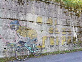
Oggi vi racconto un giro in bici che ho da tempo cercato e voluto fare... Ho iniziato a correre in bici guardando le imprese del Panta... e quale salita migliore di Montecampione per onorare la sua memoria. Salita che gli permise di vincere il suo primo e anche unico giro d’Italia.
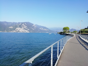
Ho raggiunto il lago d’Iseo e da quì sono partito, prima seguendo la statale e poco prima di Vello svoltando a destra, seguendo la ciclabile che fiancheggia il lago. Quest’ultima è stata una sorpresa inaspettata, penso che le foto qui sotto riportate ne descrivino in modo chiaro la sua bellezza.
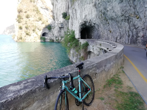
Concluso il lago si prosegue verso Pian Comuno, e subito dopo aver attraversato un ponticello si svolta a destra e per circa 1 km si fiancheggia la montagna fino a quando si inizia a salire.
20 km i primi 12 per raggiungere località Montecampione e gli ultimi 8 per raggiungere le Baite a quota 1800.
Salita impegnativa, soprattutto il primo tratto. |
|
La cosa più significativa da segnalarvi è lo stato disastroso dell’ultimo tratto della salita. Superata località Montecampione dopo un paio di KM, il fondo stradale è un disastro, si deve prestare attenzione a non forare. Ci sono lavori in corso, quindi spero sarà ripristinato nei prossimi anni..... |
Distanza percorso : m.
Dislivello : m.
Quota massima : m.
|
|
|
Altimetria Terreno (Scala altezza: 1px=10 metri) (Scala distanza: 1px=10 metri) |
|
|
|
Altimetria Percorso (Scala altezza: 1px=10 metri) (Scala distanza: 1px=10 metri) |
|
|
| Tappe |
| Titolo | Lago d’Iseo | | Testo | | | Link | | | Allegato | | | Altimetria | da 0 metri a 0 metri | | Distanza | 0 metri in linea d'aria, 0 metri percorsi |
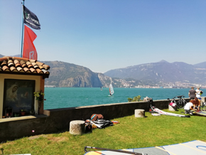
|  | | Titolo | Windsurf sul lago | | Testo | | | Link | | | Allegato | | | Altimetria | da 0 metri a 0 metri | | Distanza | 0 metri in linea d'aria, 0 metri percorsi |
|  | | Titolo | Pista ciclabile | | Testo | | | Link | | | Allegato | | | Altimetria | da 0 metri a 0 metri | | Distanza | 0 metri in linea d'aria, 0 metri percorsi |
|  | | Titolo | Inizia la salita | | Testo | | | Link | | | Allegato | | | Altimetria | da 0 metri a 0 metri | | Distanza | 0 metri in linea d'aria, 0 metri percorsi |
|  | | Titolo | Montecampione | | Testo | | | Link | | | Allegato | | | Altimetria | da 0 metri a 0 metri | | Distanza | 0 metri in linea d'aria, 0 metri percorsi |
| 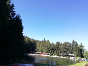 | | Titolo | Pantani | | Testo | | | Link |  | | Allegato | | | Altimetria | da 0 metri a 0 metri | | Distanza | 0 metri in linea d'aria, 0 metri percorsi |
|  | | Titolo | Le baite a quota 1800 | | Testo | | | Link | | | Allegato | | | Altimetria | da 0 metri a 0 metri | | Distanza | 0 metri in linea d'aria, 0 metri percorsi |
|  | | Titolo | Le baite a quota 1800 | | Testo | | | Link | | | Allegato | | | Altimetria | da 0 metri a 0 metri | | Distanza | 0 metri in linea d'aria, 0 metri percorsi |
|  |
|
|